






























Digital Twins for Government Infrastructure: Use Cases, Architecture and Implementation Strategy

 Share -



- 01Understanding the Importance of a Digital Twin for Government Infrastructure
- 02Why Government Infrastructure is Adopting Digital Twins
- 03What Pain Points Are Solved by Government Digital Twins
- 04What Are the Core Components of a Government-Grade Digital Twin Architecture?
- 0510 High-Impact Digital Twin Use Cases for Government Infrastructure
- 06What Are the Biggest Challenges in Implementing Government Digital Twins?
- 07How to Build a Digital Twin for Government Infrastructure: A Practical Implementation Roadmap
- 08How Much Does It Cost to Build a Government Infrastructure Digital Twin?
- 09How Should Government Leaders Measure Digital Twin ROI?
- 10Digital Twin Initiatives Government Leaders Should Watch
- 11Emerging Trends Shaping the Next Decade (2026+)
- 12How Appinventiv Helps Build Digital twin Solutions for Government Infrastructure
- 13FAQs

Key takeaways:
- Digital twin use cases for government infrastructure span predictive maintenance, transport planning, disaster response, climate resilience and more.
- NSW, Victoria and Queensland are advancing digital twin initiatives, supporting a more connected approach to infrastructure planning.
- Digital twin implementation costs may start at AUD 70,000 and exceed AUD 700,000 as infrastructure, integrations and complexity increase.
Australia’s public infrastructure pipeline is becoming larger and more digitally complex. Infrastructure Australia’s 2025 report puts the five-year Major Public Infrastructure Pipeline at $242 billion for 2024–25 to 2028–29, creating sustained pressure to improve planning, delivery and asset performance.
For government agencies, the challenge is no longer simply creating BIM models, GIS datasets or asset registers. The harder problem is connecting these information sources with operational data so infrastructure teams can understand current conditions, test scenarios and make better lifecycle decisions. That is where digital twins for government infrastructure are gaining relevance.
Australia’s digital twin direction increasingly favours spatially enabled, interoperable and federated environments rather than isolated 3D models. ANZLIC’s national principles explicitly support an ecosystem of securely shared digital twins across the built and natural environment.
For decision makers, the question is not whether a digital twin can produce a detailed visualisation. It is whether the technology can improve infrastructure decisions, reduce operational risk and create measurable value over the asset lifecycle.
This blog sets out what digital twin technology in government infrastructure actually involves, the architecture that underpins it, the use cases delivering measurable return, the state initiatives worth benchmarking, the barriers that stall adoption, and a practical roadmap for CIOs and spatial leaders evaluating custom digital twin development for government.
Assess your data maturity, system landscape, integration requirements and infrastructure use cases to identify where a digital twin can deliver measurable value.

Understanding the Importance of a Digital Twin for Government Infrastructure
A government infrastructure digital twin is a dynamic digital representation of physical assets, infrastructure networks or entire geographic environments. It combines spatial and geospatial data, BIM and engineering models, IoT and sensor feeds, asset management records, historical operational data, environmental and climate inputs, simulation engines and increasingly intelligent AI models, into one continuously updated view.
The Government Architecture describes digital twins as dynamic representations of real-world objects or systems that draw on real-time and historical data to model current conditions and simulate predicted futures. That definition is deliberately broader than “3D model.” A twin without live data feeding it and without a simulation layer sitting on top of it is a visualisation exercise, not a digital twin.
For infrastructure agencies, a twin can connect:
* GIS and spatial information
* BIM and digital engineering models
* IoT and sensor feeds
* Asset and maintenance records
* Environmental and climate data
* Operational systems
* Historical performance data
* AI and simulation models
The distinction from conventional infrastructure systems is significant:
Digital Twins vs Traditional Infrastructure Systems
| Traditional Infrastructure Systems | Digital Twin Environment |
|---|---|
| Asset data stored in separate systems | Connected data across infrastructure ecosystems |
| Static asset models | Continuously updated representations |
| Reactive maintenance | Predictive and condition-based interventions |
| Manual scenario analysis | Simulation of multiple future scenarios |
| Project-level visibility | Asset, network and system-level visibility |
| Historical reporting | Real-time and predictive intelligence |
| Isolated agency decision-making | Shared cross-agency operational context |
This distinction is what separates a genuine digital twin from conventional asset management software or a GIS layer. It also explains why digital twin infrastructure development is typically scoped as a data and integration programme first, and a visualisation project second.
Why Government Infrastructure is Adopting Digital Twins
Rising urban density across Sydney, Melbourne, and Southeast Queensland requires more efficient asset deployment. Public agencies must balance continuous asset expansion with aggressive decarbonisation targets, driving demand for predictive infrastructure platforms.
Frameworks established by ANZLIC (the Spatial Information Council) dictate data interoperability guidelines across state borders. The jurisdictions lead this rollout through key initiatives like
Key State Benchmark Initiatives
- New South Wales: The NSW Spatial Digital Twin (SDT) integrates live transport networks, property boundaries, and emergency services data to power state-wide planning and crisis management.
- Victoria: Digital Twin Victoria (DTV) introduces the eComply Framework, automating BIM-led regulatory approvals and precinct development across complex urban corridors like Fishermans Bend.
- Western Australia and Queensland: WA’s Spatial WA program committed $140 Million to create a 4D virtual replica of state assets, while Queensland leverages spatial twins for catchment-wide flood risk modeling.
What Pain Points Are Solved by Government Digital Twins
Every credible digital twin business case starts with an operational pain point, not a technology feature list. This section maps the problems agencies are actually funding solutions for.
Fragmented Data Silos Across Departments
Legacy asset management tools leave councils and state agencies working from outdated spatial snapshots, disconnected from live conditions on the ground. A unified data ecosystem connecting GIS records, IoT streams and enterprise ERP systems replaces that fragmentation with a single operational picture, reducing duplicated data entry and reconciliation effort across departments.
Disaster Response and Climate Resilience
Bushfire, flash flooding and coastal erosion events are increasing in frequency, and static contingency plans age quickly against that pace of change. Predictive 4D simulation lets emergency planners run what-if scenarios for evacuation routing and asset exposure well before an event occurs, rather than improvising during it.
Inefficient Project Approvals and Handover Compliance
Manual WHS and building regulatory audits routinely slow public works handover, often stacking weeks of delay onto already tight delivery schedules. Virtual commissioning and automated e-compliance engines, similar in principle to Victoria’s eComply model, reduce pre-handover defects and compress the audit cycle.
Lifecycle Maintenance Costs and Embodied Carbon Tracking
Agencies frequently lack continuous visibility into structural degradation or the carbon footprint of an asset across its life. IoT-driven predictive maintenance paired with a continuous ESG ledger gives finance and sustainability teams a shared, auditable record from construction through to operation.
What Are the Core Components of a Government-Grade Digital Twin Architecture?
Architecture decisions made early determine whether a twin scales across agencies or stalls as a single-department pilot. Government buyers should treat interoperability as a procurement requirement, not an afterthought.
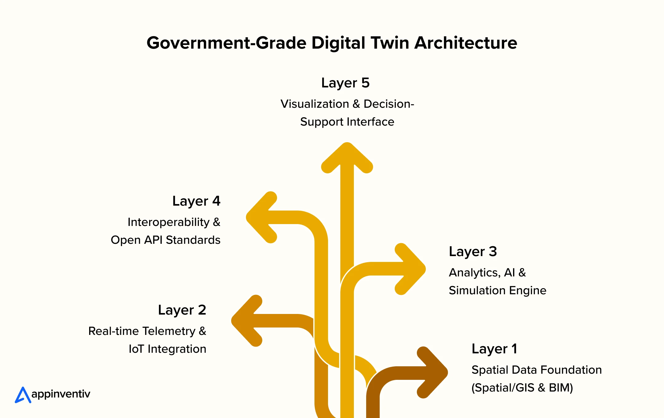
Layer 1: Spatial Data Foundation (Spatial/GIS & BIM)
Aggregates high-resolution aerial LiDAR, point-cloud scans, cadastral records, and 3D GIS models, storing physical assets according to OpenBIM (IFC) standards.
Layer 2: Real-time Telemetry & IoT Integration
Employs edge compute nodes, structural strain gauges, water level sensors, and 5G connections to process real-time environmental and asset health telemetry.
Layer 3: Analytics, AI & Simulation Engine
Leverages physics-informed machine learning models to identify anomaly patterns, simulate fluid dynamics during severe rainfalls, and predict structural failures before they disrupt operations.
Layer 4: Interoperability & Open API Standards
Enforces ISO 19650 and Open Geospatial Consortium (OGC) specifications within a federated architecture, protecting government infrastructure data from proprietary vendor lock-in.
Layer 5: Visualisation & Decision-Support Interface
Renders high-performance WebGL, browser-accessible 3D spatial environments, and executive dashboards to simplify complex data sets for operational leadership.
10 High-Impact Digital Twin Use Cases for Government Infrastructure
The strongest applications of digital twins in government infrastructure are tied to measurable infrastructure problems rather than visualisation alone. From predictive maintenance to capital planning, digital twins can give agencies a common operational picture and allow decisions to be tested digitally before resources are committed in the physical environment.
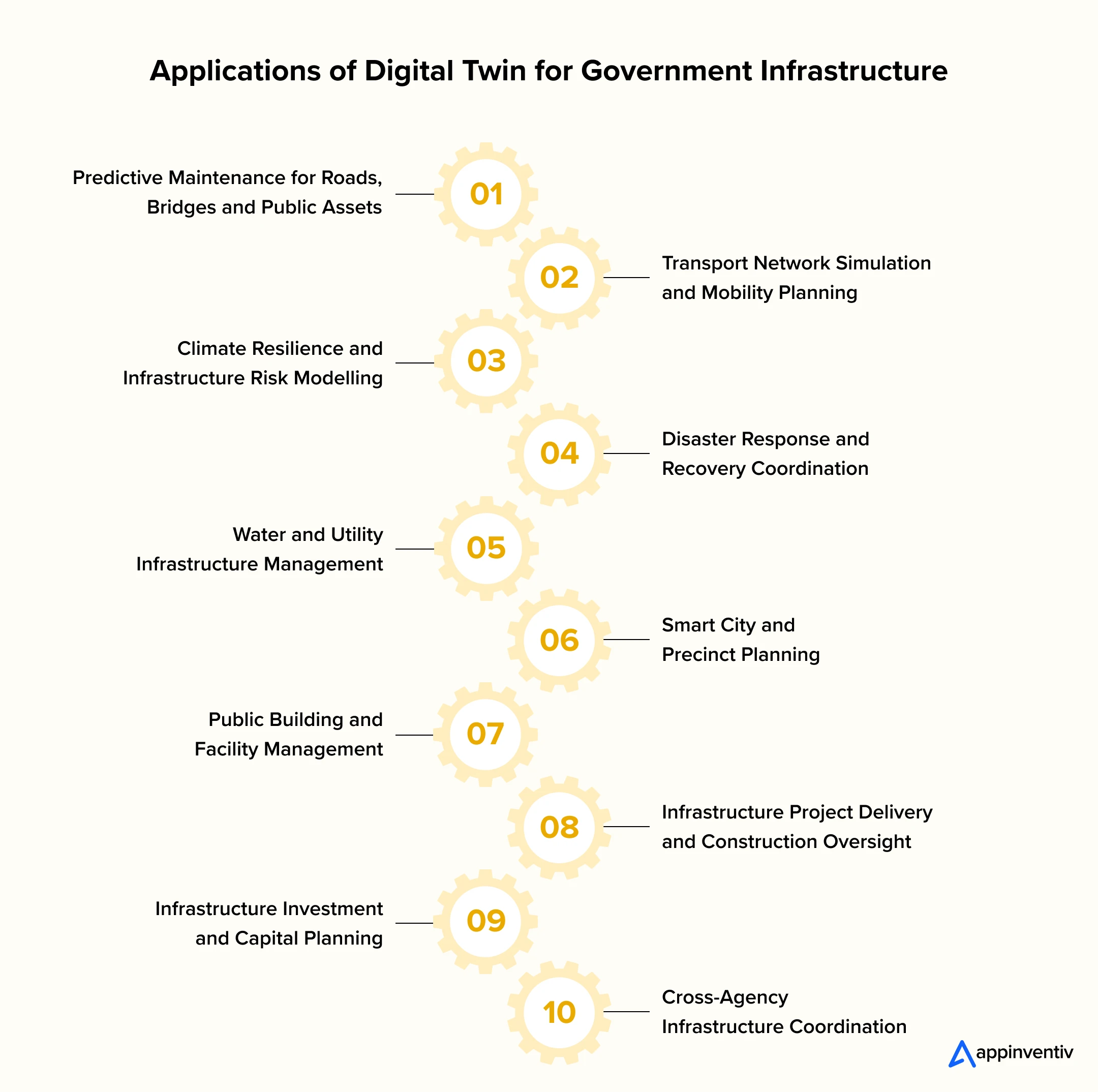
1. Predictive Maintenance for Roads, Bridges, and Public Assets
Integrating structural vibration sensors with 3D BIM models alerts engineering teams to internal degradation long before surface damage appears. Continuous predictive monitoring reduces costly emergency closures across critical transport corridors.
2. Transport Network Simulation and Mobility Planning
By combining live GPS transit data, traffic light telemetry, and pedestrian movement patterns, transport authorities simulate alternative light rail routes or lane configurations to reduce commuter congestion.
3. Climate Resilience and Infrastructure Risk Modelling
Planners stress-test physical structures against extreme heat, rising sea levels, and severe rainfall events. Modeling structural stress in a virtual environment helps agencies reinforce vulnerable assets before disasters occur.
4. Disaster Response and Recovery Coordination
During active bushfires or urban flash floods, emergency response teams use dynamic 4D models to track fire fronts, monitor rising waters, and direct first responders through safe evacuation paths in real time.
5. Water and Utility Infrastructure Management
Sub-surface digital twins map subterranean pipe networks alongside real-time pressure feeds. This visibility allows utility operators to detect hidden leaks early, balance flow dynamics, and avoid disruptive street excavations.
6. Smart City and Precinct Planning
Urban planners run multi-variable shadow, noise, wind, and traffic impact simulations within unified precinct models, ensuring major urban redevelopments conform to environmental guidelines before breaking ground.
7. Public Building and Facility Management
Integrating building control systems (HVAC, lighting, occupancy sensors) into a centralized spatial interface optimizes energy consumption across schools, hospitals, and administrative centers, lowering carbon emissions.
8. Infrastructure Project Delivery and Construction Oversight
Comparing site drone scans against baseline 4D construction timelines allows project directors to identify schedule slip, monitor material deployment, and verify contractor work against safety guidelines.
9. Infrastructure Investment and Capital Planning
Treasury departments evaluate asset performance metrics and population growth projections within a shared spatial model, helping decision-makers direct limited capital budgets toward the highest-priority developments.
10. Cross-Agency Infrastructure Coordination
Spatial twins provide a shared operational environment where road authorities, telecommunications providers, and energy distributors coordinate underground works, avoiding redundant street excavations.
What Are the Biggest Challenges in Implementing Government Digital Twins?
Complex digital transformation projects carry operational, technical, and political risks. Identifying these structural challenges early helps executives implement effective mitigation strategies that keep deployments on schedule.
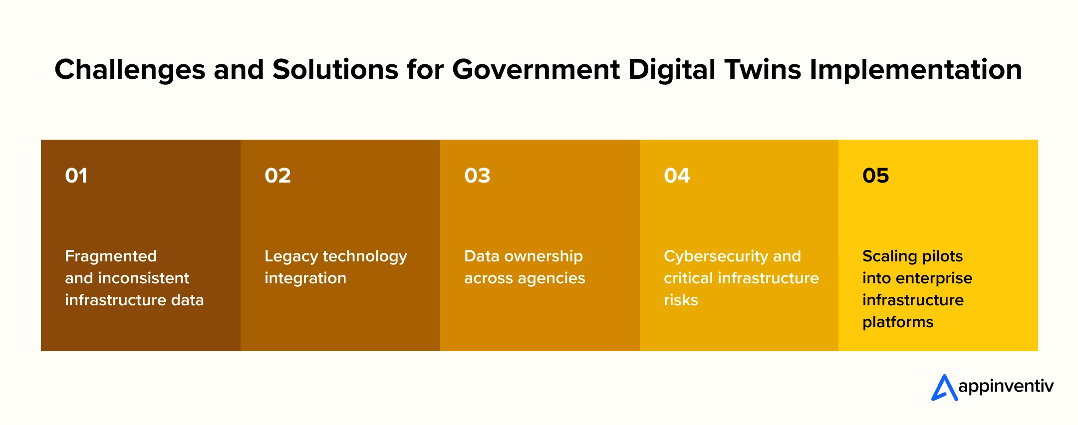
Fragmented and Inconsistent Infrastructure Data
- The Challenge: Legacy infrastructure records are often split across paper archives, proprietary CAD files, and disconnected spreadsheets, preventing automated data ingestion.
- The Solution: Establish strict ISO 19650 data ingestion guidelines, automated data-cleaning scripts, and open spatial formats prior to building centralized digital platforms.
Legacy Technology Integration
- The Challenge: Mainframe asset databases and aging SCADA networks were never built to export live data into modern WebGL interfaces.
- The Solution: Develop secure microservices architectures and API adapter layers that read legacy telemetry without threatening operational continuity.
Data Ownership Across Agencies
- The Challenge: State departments and local councils often resist sharing asset data due to privacy concerns, regulatory ambiguity, or departmental siloing.
- The Solution: Draft formal inter-agency data governance charters that enforce role-based access controls, masking sensitive information while making functional spatial data available.
Cybersecurity and Critical Infrastructure Risks
- The Challenge: Centralising operational controls and spatial models for power grids or water systems creates high-value targets for hostile cyber attacks.
- The Solution: Enforce Zero Trust network architectures, end-to-end data encryption, and local data hosting compliant with the Australian Government’s Information Security Manual (ISM).
Scaling Pilots into Enterprise Platforms
- The Challenge: Proof-of-concept projects often stall due to unscalable custom code, missing governance frameworks, or unexpected ballooning costs.
- The Solution: Build pilots using enterprise-grade cloud architectures, clear performance metrics, and scalable API pipelines designed for broader state-wide expansion from day one.
How to Build a Digital Twin for Government Infrastructure: A Practical Implementation Roadmap
Transitioning from high-level planning to enterprise deployment requires a structured approach. Following an 8-phase implementation roadmap reduces commercial risk and aligns technology investments with public value objectives.
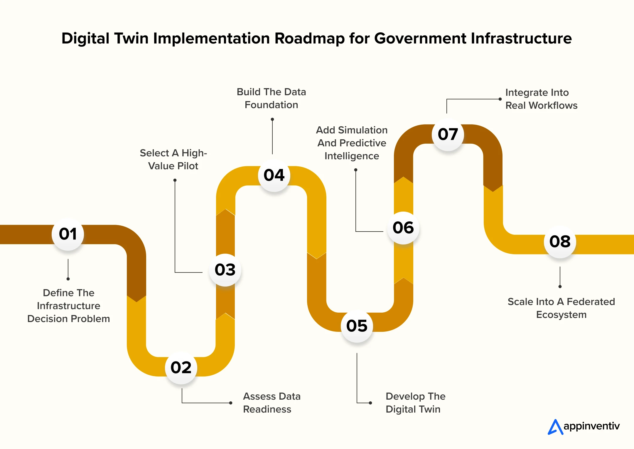
Define the Decision Problem
Identify which infrastructure decision needs improvement. Examples include maintenance prioritisation, flood response, transport planning or capital allocation.
Assess Data Readiness
Review existing GIS, BIM, asset, IoT and operational datasets. Assess quality, ownership, accessibility and integration requirements.
Select a High-Value Pilot
Choose an asset, corridor or precinct where the outcome can be measured. The pilot should have a clear operational owner and an identifiable business case.
Build the Data Foundation
Establish common data structures, APIs, integration pipelines, security controls and governance processes.
Develop the Digital Twin
Connect the selected data sources and create the minimum twin capabilities required for the chosen operational use case.
Add Predictive Intelligence
Introduce forecasting, anomaly detection, simulation and AI-powered digital twins where these capabilities improve a defined decision.
Embed the Twin Into Workflows
Connect insights to maintenance, planning, emergency response or capital management processes. A twin that sits outside operational workflows will struggle to create sustained value.
Scale Into a Federated Ecosystem
Once the operating model is proven, connect additional assets, systems and agencies using agreed standards and governance controls.
From data integration and spatial modelling to AI-powered analytics and enterprise workflows, build a digital twin solution aligned with your infrastructure priorities.
How Much Does It Cost to Build a Government Infrastructure Digital Twin?
Digital twin software development cost for government infrastructure varies substantially by scope and data maturity, so agencies should budget against a cost-driver framework rather than a single headline figure. This protects both procurement teams and delivery partners from scope mismatch later.
On average, the cost for government-grade digital twin work typically ranges between AUD 70,000 and AUD 700,000 or more, depending on scope, existing data quality and the number of integrated systems.
| Digital Twin Scope | Estimated Cost Range | Key Cost Drivers |
|---|---|---|
| Asset-level twin | AUD 70,000 and 150,000 | Sensor deployment, single-system integration, basic visualisation |
| Infrastructure network twin | AUD 150,000 and 300,000 | Data volume, multiple source systems, predictive analytics |
| Precinct or city twin | AUD 300,000 and 500,000 | GIS and 3D data complexity, multiple stakeholder inputs |
| Federated government ecosystem | AUD 500,000 and 700,000 | Interoperability, cross-agency governance, security, long-term scale |
Key cost factors beyond scope include the number of assets being modelled, existing data quality, IoT infrastructure maturity, the extent of legacy system integration required, GIS and BIM maturity, simulation complexity, AI capability requirements, cybersecurity controls, hosting architecture and long-term operational support. Agencies evaluating a custom digital twin development for government partner should ask for a cost breakdown against each of these drivers rather than a single lump-sum figure, since that breakdown is what makes budget variance explainable later.
How Should Government Leaders Measure Digital Twin ROI?
ROI of digital twins for government infrastructure extends well beyond maintenance savings. Executives building a business case should quantify value across five distinct categories to capture the full picture the technology actually delivers.
- Operational ROI: Calculated through lower manual inspection expenses, reduced energy consumption across public facilities, and minimized asset downtime.
- Capital ROI: Achieved by extending physical asset lifespans, optimizing capital project scheduling, and avoiding premature asset replacements.
- Resilience ROI: Measured by avoided property damage, optimized emergency response times, and reduced infrastructure restoration costs following natural disasters.
- Productivity ROI: Gained by reducing manual approval cycles, streamlining inter-agency data requests, and automating regulatory reporting workflows.
- Public Value ROI: Reflects broader community benefits, including lower traffic congestion, improved emergency response, and reduced municipal carbon footprints.
A practical formula for framing the business case to a board or funding committee is:
Digital Twin Value = Operational Savings + Avoided Risk + Improved Capital Decisions + Productivity Gains + Public Service Outcomes
This framework gives executives a structure for building a defensible business case rather than relying on generic efficiency claims that rarely survive budget scrutiny.
Digital Twin Initiatives Government Leaders Should Watch
The country is not starting from zero. State and national initiatives provide useful reference points for interoperability, spatial data and infrastructure modelling. These programmes also demonstrate why a government digital twin should be considered as part of a wider ecosystem rather than as an isolated departmental application.
NSW Spatial Digital Twin
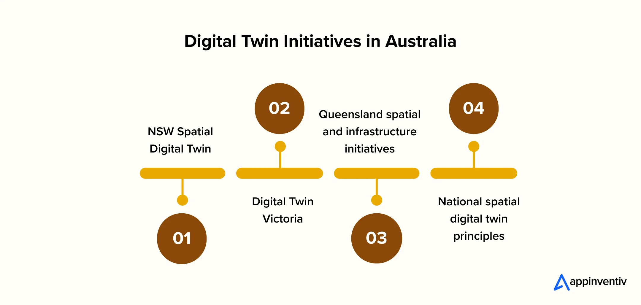
Backed by a $40 million investment from the NSW Digital Restart Fund and now covering high-growth council areas with mandatory agency data contribution from May 2025, the NSW Spatial Digital Twin is arguably the most mature state-level programme in the country, integrating transport, emergency services and planning data on one platform.
Digital Twin Victoria
Victoria’s record $37.4 million investment in digital twin technology and spatial innovation over four years has produced the DTV platform and the eComply automated compliance tool, which now runs building design checks against planning codes in a fraction of the time manual assessment previously took.
Queensland Spatial and Infrastructure Initiatives
Queensland has extended the ANZLIC principles into a state-specific framework guiding spatially enabled digital twins across utility, flood risk and resource-corridor infrastructure, giving councils and agencies a consistent implementation reference.
National Spatial Digital Twin Principles
ANZLIC’s national principles, drawing on the UK’s Gemini Principles from the Centre for Digital Built Britain, give every state a common foundation for interoperability, positioning the country for a federated, cross-jurisdictional digital twin ecosystem over the coming decade.
Emerging Trends Shaping the Next Decade (2026+)
Advancements in natural language AI processing, autonomous robotics, and cross-border data alignment are altering infrastructure operations. Early adoption of these tools ensures agencies maintain cyber resilience and long-term asset scalability.
AI-Powered Digital Twins for Infrastructure
AI in Australia can identify anomalies, forecast asset deterioration and surface relationships across large infrastructure datasets. The strongest applications will remain those where predictive intelligence leads to a specific operational action.
Generative AI and Spatial Intelligence
Natural-language interfaces and Gen AI use cases could allow infrastructure teams to query complex datasets without navigating multiple specialist systems.
For example, a planning team could ask which assets are exposed to a particular hazard and require intervention within a defined timeframe.
Autonomous Inspection and Robotics
Drones, remote inspection systems and robotics can provide new streams of asset-condition data. Connecting those observations to the digital twin could shorten the cycle between physical inspection and maintenance decision-making.
Federated Digital Twin Ecosystems
The country’s direction is increasingly centred on connected but governed digital twins rather than a single centralised model. This can support data sharing while preserving agency ownership and access controls.
Cyber Resilience and Data Sovereignty
As twins become connected to operational infrastructure, security requirements will become more demanding. Architecture should account for sensitive infrastructure information, data sovereignty, access controls and long-term auditability from the outset.
How Appinventiv Helps Build Digital twin Solutions for Government Infrastructure
Deploying government-grade digital twins requires balancing technical innovation with strict regulatory compliance.
At Appinventiv, we bring over 11 years of APAC delivery experience, supporting public sector partners with tailored software engineering, spatial data integration, platform modernisation and digital transformation services.
We hold ISO 27001, ISO 9001, and SOC2 certifications, maintaining a 90% client retention rate and 99.5% security compliance SLA.
Being approved on the Queensland Government ICTSS and Local Buy LGA procurement panels, we deliver secure, scalable digital twin solutions for 35+ industries, including the government sector.
Our team of 1700+ tech experts works closely with C suite executives to design and deploy secure, interoperable spatial twins that break down data silos, support predictive maintenance, and streamline regulatory compliance.
Whether you need to build custom API integrations for legacy SCADA systems or establish a federated precinct twin, our engineers ensure your platform remains secure, audit-ready, and scalable.
Discuss your project vision with us and get a digital twin strategy tailored to your specific project needs.
FAQs
Q. What is a digital twin in government infrastructure?
A. A digital twin in government infrastructure is a continuously updated digital representation of a physical asset, network or geographic area, combining spatial data, BIM models, IoT sensor feeds and simulation capability. Unlike a static 3D model, it reflects current conditions in near real time and can simulate future scenarios such as flood impact, traffic load or structural fatigue, giving agencies a decision-support tool rather than just a visual reference.
Q. How are governments using digital twins?
A. Agencies are using digital twins for predictive maintenance of roads and bridges, transport network simulation, climate and disaster risk modelling, water utility management, precinct planning and cross-agency infrastructure coordination.
State programmes such as the NSW Spatial Digital Twin and Digital Twin Victoria integrate multiple agencies’ data onto shared platforms, allowing transport, emergency services and planning departments to work from one consistent operational picture rather than isolated data sets.
Q. What is the difference between BIM and a digital twin?
A. BIM produces a detailed static or semi-static model of a building or asset during design and construction, primarily used for design coordination and documentation. A digital twin extends beyond that by connecting to live operational data through sensors and IoT feeds, updating continuously and running simulations against real-world conditions. In practice, BIM data often forms one input layer within a broader digital twin, rather than being a substitute for it.
Q. How can digital twins improve infrastructure resilience?
A. Digital twins improve resilience by allowing agencies to run predictive simulations, such as flood modelling or bushfire spread scenarios, against actual asset locations and conditions before an event occurs. This lets emergency planners identify high-risk infrastructure, pre-position resources and test evacuation routing well ahead of time, rather than responding reactively once an incident is already underway.
Q. What technologies are needed to build a government infrastructure digital twin?
A. A government-grade digital twin typically requires a spatial data foundation built on GIS and BIM standards, IoT sensors and edge computing for real-time telemetry, an AI and simulation engine for predictive analytics, open API standards for interoperability across agencies, and a visualisation layer covering 3D web interfaces, dashboards and increasingly AR or VR tools for operational teams.
Q. Can multiple government agencies share a digital twin?
A. Yes, and this is increasingly the direction state programmes are moving in. Shared digital twins require clear data governance agreements covering ownership, update responsibility and access permissions across agencies, along with an interoperable, standards-based architecture from the outset. The NSW Spatial Digital Twin’s mandatory data contribution policy for state agencies is one working model of how this cross-agency sharing is being formalised.
Q. How do governments measure digital twin ROI?
A. Government ROI on digital twins is typically measured across five categories: operational savings from reduced maintenance and downtime, avoided risk from better disaster and climate modelling, improved capital investment decisions, productivity gains from faster cross-agency coordination, and broader public service outcomes. Agencies building a business case increasingly use a combined framework rather than isolated efficiency metrics, since twin value compounds across categories rather than sitting in one line item.


Fast 2-minute response, fully NDA-protected.

Smart Infrastructure for the Public Sector: Use Cases, Technologies and Implementation Strategy
Key takeaways: Smart infrastructure connects physical assets, data, technology and governance to improve public services and operational outcomes. Australia's $242 billion infrastructure pipeline and a shortfall of 300,000 workers makes asset-level intelligence a delivery necessity, not an innovation extra. Smart infrastructure use cases demonstrate how AI, IoT, digital twins and analytics can transform infrastructure management.…
Creating a Digital Transformation Strategy in the UK: From Vision to Execution
Key takeaways: A digital transformation strategy succeeds for UK businesses when it is governed as a single programme, not a portfolio of disconnected technology purchases. UK transformation budgets should prioritise modernising legacy systems and strengthening data foundation before scaling advanced capabilities. AI delivers return only when built on governed data and a change-ready operating model,…

How to Hire a Digital Transformation Partner: Discussing Steps, Costs, and More
Key takeaways: Choose partners with proven enterprise expertise. Validate costs beyond implementation budgets. Prioritize AI, cloud, and legacy together. Build compliance into every transformation phase. Pilot before committing to large-scale delivery. Most enterprise modernization programs do not fail on technology. They fail on the vendor decision made in week one. If you are preparing to…