


Geospatial AI: Transforming Analytics with Spatial Intelligence

- What Is Geospatial AI and How It Can Transform Your Business
- Key Benefits of Geospatial AI for Boosting Your Business Performance
- Real-World Geospatial Analytics Use Cases That Drive Business Success
- The Future of Geospatial AI: Trends and Opportunities for Businesses
- Lead the Geospatial AI Race with Appinventiv
- FAQs

Geospatial AI is revolutionizing how we understand and interact with our world. It offers unparalleled insights into spatial data, transforming analytics with its intelligence. The technology blends artificial intelligence with geographic data, providing dynamic solutions across various sectors.
Using AI in geospatial analytics stands as a pivotal element in this revolution, enabling sophisticated analysis and decision-making processes. The AI integration services and technologies with geospatial data unleashes the potential for predictive modeling, real-time analysis, and spatial recognition on an unprecedented scale. Amidst this innovation, the geospatial analytics market is witnessing significant growth.
According to a recent report by Grand View Research, the market was valued at $85.77 billion in 2022 and is projected to reach $226.53 billion by 2030, expanding at a CAGR of 12.6% from 2023 to 2030. The rapid growth highlights how much industries value geospatial AI, using it for everything from city planning to environmental protection.

As more organizations look to make smarter decisions with geospatial data, the need for advanced geospatial AI solutions is on the rise. This trend points to a future where geospatial AI will play a key role in how we understand and manage our world.
This blog will dive deep into how geospatial AI is not just an innovation but a transformative force in analytics. But first, let’s understand what GeoAI is all about in brief.

What Is Geospatial AI and How It Can Transform Your Business
Geospatial Artificial Intelligence (GeoAI) is a branch of Artificial Intelligence that combines the analytical power of AI with geographic data to provide insights and solutions across a wide range of industries. Businesses can leverage the power of geospatial AI to analyze spatial data in more sophisticated ways, enabling them to make predictions, optimize operations, and understand trends like never before.
The technology is capable of revolutionizing the operations in urban planning, environmental monitoring, and logistics, paving the way for increased levels of precision in the decision-making processes.
Integrating GeoAI into your business strategy can notably enhance your ability to utilize spatial data, resulting in more intelligent and well-informed choices. By employing GeoAI, organizations can adeptly navigate the intricacies of the current data-centric environment, ultimately positioning themselves for success in a fiercely competitive digital ecosystem. This adoption represents a crucial advancement towards embracing technological advancements and optimizing the utility of geospatial data within business operations.
Key Benefits of Geospatial AI for Boosting Your Business Performance
Geospatial AI is transforming the way we analyze and interpret spatial data. This technology offers innovative solutions for a variety of challenges, enabling precise decision-making and predictive analysis across multiple industries. Let us look at some of the major benefits of geospatial AI in detail below.

Enhanced Decision Making
Decision-making becomes more efficient with precise data analysis. Organizations can predict outcomes more accurately thanks to spatial data insights. This precision is vital for industries like logistics and urban planning. The use of AI in geospatial analytics significantly improves this process. It allows for the processing of complex data sets quickly.
As a result, companies can make informed decisions faster than ever before. This ability is crucial for staying ahead in competitive markets. It also supports sustainable development by optimizing resource allocation. The impact of this technology on strategic planning is profound as it helps in transforming data into actionable intelligence.
[Also Read: AI in Sustainability]
Improved Efficiency and Cost Savings
Efficiency is paramount in today’s fast-paced world. Geospatial AI streamlines operations, reducing time spent on data analysis. This technology automates the processing of vast geographical datasets. Furthermore, it ensures faster delivery of insights, which is crucial for real-time decision-making. Businesses leverage this to optimize routes, reducing fuel costs and improving delivery times.
Using AI in geospatial data analysis significantly cuts operational expenses. Companies benefit from reduced labor costs and enhanced resource management. These savings can be redirected towards innovation and growth, bolstering competitive advantage. Geospatial AI is a key driver for operational efficiency and cost reduction.
Advanced Predictive Capabilities
Advanced predictive capabilities are among the key benefits of geospatial AI. This technology processes spatial data to forecast future scenarios with remarkable accuracy. It enables organizations to anticipate changes and trends, facilitating proactive decision-making.
Geospatial AI’s predictive power extends across various domains, from environmental conservation to urban planning. It helps in ensuring that resources are utilized optimally. By analyzing patterns and correlations within geographic information, it identifies potential risks and opportunities ahead of time.
This foresight allows for better strategic planning, risk management, and investment decisions. Ultimately, the advanced predictive capabilities of geospatial AI empower stakeholders to navigate future challenges more effectively. Thus helping them in securing a competitive advantage and fostering sustainable development.
[Also read- Predictive Analytics Software Development Guide]
Increased Accessibility and Equity in Services
Geospatial AI significantly enhances the equity and accessibility of services across various sectors. This technology enables the precise identification of areas where services are most needed, ensuring that resources are allocated more efficiently and fairly. Through the analysis of vast amounts of spatial data, geospatial artificial intelligence aids in the equitable distribution of healthcare, education, and other critical services, directly addressing disparities within communities.
It supports the development of strategies that aim to provide universal access to essential resources, thereby promoting inclusivity. By optimizing the delivery of services to underserved populations, geospatial AI plays a vital role in fostering a more equitable society. It ensures that every individual has access to the services they need.
Real-Time Data Analysis
Real-time data analysis, empowered by geospatial AI, significantly enhances operational efficiency and decision-making. This advanced technology processes and interprets spatial data instantly, providing crucial insights when time is of the essence. Its capacity for immediate analysis leads to substantial improvements in how organizations respond to dynamic conditions. The accuracy and speed of geospatial artificial intelligence enable better resource allocation, minimizing waste and reducing costs.
It also allows businesses to adapt to market changes swiftly, maintaining a competitive edge. Furthermore, real-time insights contribute to smarter, more informed strategic planning across various industries. Thus demonstrating the profound benefits of integrating geospatial AI into daily operations.
Improved Public Safety and Security
Improved public safety and security are critical benefits of geospatial AI. This technology enables more effective monitoring and management of risks across urban and rural areas. By analyzing geographic data, geospatial AI identifies potential hazards, from natural disasters to human-induced threats. It enhances emergency response strategies by predicting where resources will be needed most. The ability to visualize complex data geographically aids law enforcement in crime prevention and investigation.
Furthermore, geospatial AI supports infrastructure resilience, helping to safeguard key utilities and services against disruptions. These advancements contribute significantly to the well-being of communities, ensuring a safer environment for everyone.
Real-World Geospatial Analytics Use Cases That Drive Business Success
Geospatial analytics is revolutionizing how we understand and interact with the world around us. From urban planning to environmental monitoring, its applications are vast. Let us look at some of the geospatial analytics use cases in detail below.

Environmental Monitoring
Geospatial Artificial Intelligence is utilized in environmental monitoring to observe and safeguard our planet’s ecosystems. It maps changes in vegetation, water bodies, and urban expansion accurately. This approach detects pollution, tracks climate change effects, and identifies illegal land use. By analyzing satellite imagery, geospatial AI pinpoints areas of environmental concern quickly. It enables timely interventions to mitigate adverse effects on natural habitats.
Conservation strategies benefit greatly, ensuring targeted protection efforts. This technology also monitors air quality, aiding in the fight against pollution. Additionally, it assesses disaster risks, improving emergency preparedness. Through precise data analysis, geospatial AI supports sustainable management and conservation policies, safeguarding environmental health for future generations.
Urban Planning
Urban planning can greatly benefit from the application of AI for geospatial analytics. This technology can analyze complex data to assist in designing smarter cities. It can predict population growth, enabling efficient allocation of resources and infrastructure development. AI can identify optimal locations for public services, enhancing accessibility. It can also improve traffic flow and reduce congestion through predictive modeling.
This tool can support sustainable urban development by integrating environmental considerations into planning processes. Additionally, it can facilitate the revitalization of urban areas, identifying underutilized spaces for redevelopment. By providing comprehensive insights into urban dynamics, AI can help create more livable, resilient, and efficient urban environments.
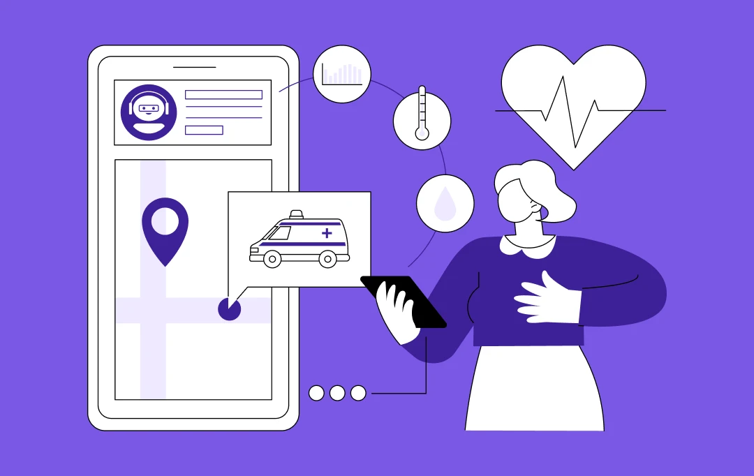
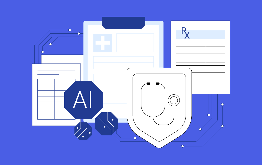
Health and Epidemic Tracking
Health and epidemic tracking is one of the critical use cases of geospatial AI. This technology can map the spread of diseases in real time, identifying hotspots and trends. It can analyze various data sources, such as travel patterns and climate conditions, to predict future outbreaks.
Applications of GeoAI in public health can also tailor intervention strategies, optimizing resource allocation for maximum impact. This approach can enhance vaccination campaigns, focusing efforts where they are needed most.
It can monitor the effectiveness of public health measures, adjusting strategies in response to emerging data. It can provide a detailed understanding of how diseases spread geographically. Geospatial AI systems can support more effective and targeted responses to public health crises, ultimately saving lives and resources.
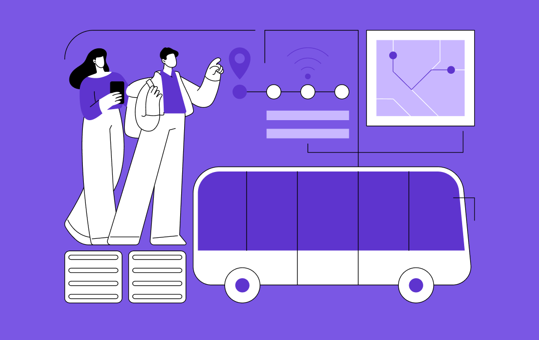
Transportation and Logistics
Transportation and logistics can greatly benefit from AI in geospatial analytics. It optimizes route planning, saving time. Traffic predictions further enable smarter rerouting. Delays are, thus, significantly reduced and delivery schedules become more precise.
Leveraging AI-powered predictive geospatial intelligence solutions can be transformative in the transportation and logistics industry. It can enhance supply chain efficiency, identifying bottlenecks for swift resolution. Furthermore, fleet management can also witness major improvements, through continuous vehicle health monitoring and efficient planning of maintenance schedules.
Operations across the industry are becoming smoother, leading to notable increases in sustainability and efficiency, ultimately reducing costs. By reshaping logistics with smarter solutions, geospatial analytics paves the way for more reliable and eco-friendly transportation methods, advancing the industry towards innovative and effective practices.
Agriculture and Land Use
Agriculture and land use can be profoundly transformed by using AI for geospatial analysis. This technology can allow for detailed monitoring of soil health, potentially optimizing irrigation. It can facilitate timely crop health assessments, predicting pest outbreaks before they occur. Sustainable farming practices can be enhanced, potentially increasing productivity. Land use planning can become more accurate, promoting responsible resource management.
Environmental impacts could be minimized through strategic planning. Crop rotation strategies might be refined, improving soil fertility. Fertilizer use could be more strategically managed, reducing waste. Water resources might be conserved more effectively. This approach could elevate agricultural efficiency and sustainability, offering farmers tools to improve yields while conserving the environment.
Renewable Energy Siting
Geospatial AI can optimize renewable energy siting by accurately assessing wind and solar potential. This technology identifies the optimal locations for wind farms and solar panels. Environmental impacts are minimized by selecting suitable sites. It enables the analysis of land use compatibility. Infrastructure planning becomes more efficient and effective. Project development times might be reduced.
Energy production can be maximized, aligning with sustainability goals. Cost savings are possible through strategic site selection. Overall, project feasibility and efficiency improved. This approach supports the transition to renewable energy. It aids in meeting global energy demands sustainably.
Disaster Response and Management
Disaster response and management can be transformed by the application of geospatial analytics. This approach allows for quick mapping of affected areas. Thus guiding rescue and relief operations effectively. It enables the prediction of disaster paths, facilitating early evacuation efforts. Targeted allocation of resources ensures aid reaches those in need promptly. Safe evacuation routes and aid delivery paths are identified efficiently.
Prioritization of recovery efforts is based on accurate damage assessments, speeding up the rebuilding process. It also aids in swiftly restoring communication networks and coordinating international assistance. It enhances long-term planning for disaster resilience.
Retail Business Optimization
Retail businesses can leverage applications of GeoAI for strategic decision-making. This technology can identify ideal locations for new stores. It analyzes consumer demographics and behavior patterns. Market trends are understood better, enabling tailored marketing strategies. Inventory levels can be optimized based on geographic sales data. The impact of geospatial analytics also extends to AI-driven supply chain management. It identifies efficient routes, reducing delivery times and costs.
Customer satisfaction improves with personalized service offerings. The competitive analysis becomes more precise, guiding business growth. Overall, GeoAI supports smarter, data-driven retail decisions. This approach maximizes profitability and enhances customer experience.
Satellite Imagery and Remote Sensing
The integration of artificial intelligence and geospatial analytics revolutionizes the use of satellite imagery and remote sensing. This combination can enhance environmental monitoring, detecting changes in land use and vegetation. It enables precise weather forecasting, improving disaster readiness and response.
These use cases of geospatial AI highlight the versatility and power of the technology and how it’s transforming numerous industries, driving innovation and efficiency. It is vital to understand that the integration of artificial intelligence and geospatial analysis is paving the way for innovative solutions and smarter decision-making. Let’s move further to see what the future holds for further advancements in this dynamic field.

The Future of Geospatial AI: Trends and Opportunities for Businesses
The arena of geospatial artificial intelligence is rapidly evolving, promising revolutionary changes across various sectors. Its potential to transform data analysis and decision-making is immense. Here are the anticipated advancements that can be expected by the integration of artificial intelligence and geospatial analysis in the future.
Innovations on the Horizon
Innovations in geospatial analysis are set to redefine spatial intelligence. Enhanced algorithms will improve predictive accuracy for weather and natural disasters. Real-time data processing will become faster, aiding emergency responses and urban planning.
Furthermore, machine learning models will offer deeper insights into environmental changes, supporting conservation efforts and automated image recognition will revolutionize land use monitoring and agricultural practices.
Advanced analytics will enable more precise resource allocation, optimizing logistics and supply chains. These developments promise to enhance global sustainability efforts, making operations across sectors more efficient. As the use of AI for geospatial analysis evolves, its potential for transformative impacts on society and the environment continues to grow.
The integration of 3D technology into geospatial artificial intelligence (GeoAI) will also mark a pivotal advancement in the field, offering an enriched layer of data visualization and analysis. By creating detailed 3D models that encapsulate a region’s terrain, infrastructure, and environmental conditions, GeoAI will provide even more accurate predictions and insights.
The Role of Big Data and Cloud Computing
Big data and cloud computing are pivotal in advancing the use of AI in geospatial analysis. They enable handling vast datasets, which is crucial for accurate spatial insights. Cloud platforms offer scalable resources, facilitating complex computations without infrastructure constraints. Big data business analytics powered by AI can reveal patterns and trends in geospatial information.
This synergy enhances predictive modeling for climate change, urban planning, and disaster response. Cloud-based AI tools make geospatial analysis more accessible, democratizing data insights. The integration of these technologies ensures that the usage of AI for geospatial analysis remains at the forefront of innovation, driving efficiency and precision in numerous applications.
Businesses can envision a future of geospatial Artificial Intelligence where its applications will be even more integral and innovative, shaping a smarter world.
Also read:- Top AI Trends
Challenges and Considerations
The advancement of AI in the geospatial field brings unique challenges and considerations. Data privacy and security emerge as primary concerns, requiring stringent protocols. The accuracy of AI predictions depends heavily on the quality of data collected.
Ensuring this can be challenging due to the vastness and variability of geospatial information. Furthermore, interoperability between different AI systems and geospatial technologies poses another hurdle, necessitating standardized frameworks.
The computational demand of processing large datasets calls for a more robust infrastructure. The ethical implications of applications of GeoAI in surveillance and monitoring must be carefully managed. Collaborating with a dedicated AI development firm can help businesses in addressing these challenges and harnessing the full potential of AI in geospatial analytics, paving the way for innovative solutions in various sectors.
Lead the Geospatial AI Race with Appinventiv
At Appinventiv, we utilize AI geospatial technology to revolutionize the way businesses interpret geographic data. Our innovative approach unlocks unprecedented insights, transforming spatial information into strategic assets.
Our experts focus on enhancing predictive modeling for a variety of GeoAI applications, from urban development to environmental conservation. Our custom AI and machine learning solutions are designed to optimize logistics, improve response strategies in critical situations, and support sustainable practices.
Leveraging our expertise in delivering top-notch AI development services, we offer our clients a significant competitive edge, enabling smarter, data-driven decisions. Our approach integrates cutting-edge AI with geospatial analytics to create bespoke, future-ready solutions tailored to your business needs.
Partner with Appinventiv to navigate the complexities of spatial data and transform it into valuable, actionable intelligence.
FAQs
Q. How can businesses benefit from implementing geospatial AI solutions?
A. Implementing AI in geospatial analytics allows businesses to optimize operations and reduce costs. Enhanced decision-making comes from precise, data-driven insights. It also improves customer engagement through targeted services and predicts market trends for strategic planning.
Q. What are the key applications of geospatial AI across different industries?
A. Geospatial AI applications vary widely across industries. Let us offer you a glimpse of the wide-ranging applications of geospatial AI:
- In agriculture, it enhances yield predictions and soil health monitoring.
- Urban planning benefits from improved infrastructure development and traffic management.
- Environmental monitoring uses it for tracking changes and predicting natural disasters.
- Retailers optimize location strategies and customer analysis with geospatial insights.
Q. How is the future of geospatial AI expected to evolve with advancements in AI and big data?
A. The future of geospatial AI is poised for significant growth with AI and big data advancements. Enhanced accuracy in spatial data analysis will drive innovation. Real-time processing capabilities will improve. Predictive geospatial analytics will become more sophisticated, transforming sectors like urban planning, environmental protection, and logistics with unprecedented efficiency and insight.

- In just 2 mins you will get a response
- Your idea is 100% protected by our Non Disclosure Agreement.

Implementing Machine Learning Governance: Steps, Costs, Challenges, and Solutions
Key takeaways: Machine learning governance helps enterprises manage AI risk, ensure compliance, and maintain control throughout the ML lifecycle. Organizations with strong governance frameworks scale AI faster while reducing operational, regulatory, and financial risks. Effective ML governance requires model inventory, risk classification, clear ownership, continuous monitoring, and automated audit trails. Building governance into AI projects…
Key takeaways: AI in the insurance industry in Australia has crossed from experimentation into operational deployment, with claims automation, fraud detection, and dynamic pricing delivering measurable returns. APRA's April 2026 letter is a direct instruction to boards and executive management: AI governance, lifecycle ownership, and explainability are current compliance obligations enforced under existing prudential standards,…
How to Build LangChain Agents for Autonomous Workflows: A Complete Guide
Key takeaways: Autonomous LangChain agents now orchestrate finance, support, compliance, and IT workflows across enterprise systems in real time. LangGraph enables long-running, stateful AI workflows with checkpoint recovery, branching execution, and human approval controls. Enterprise AI agents require orchestration, governance, observability, and memory management beyond traditional prompt engineering techniques. Multi-agent architectures are replacing static automation…